|
|
|
|
|
|
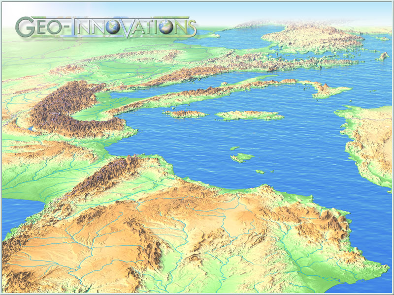
TERRAIN VISUALISATION - PANORAMIC MAPS
Imagine the world as it really is.
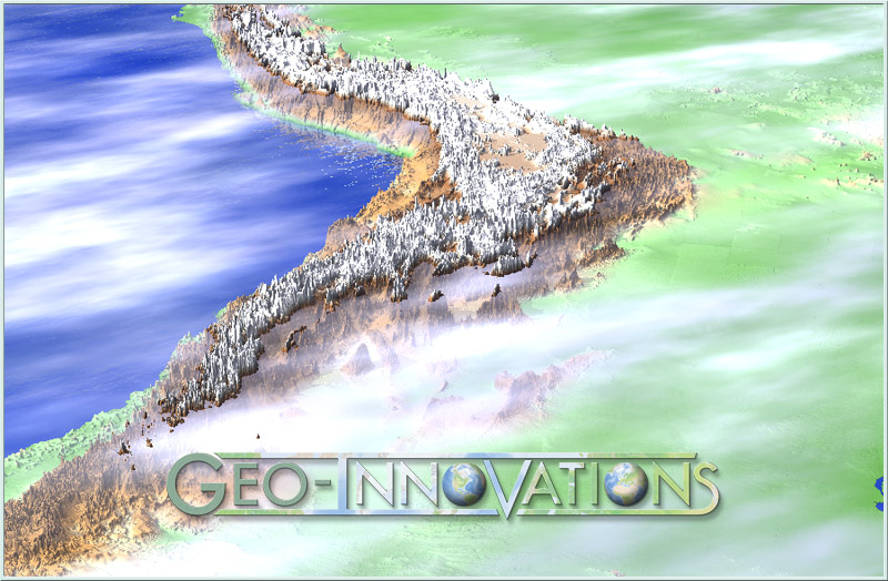
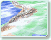
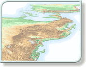
Imagine looking south from Alaska at the great Rockies range! It has an unnerving effect. We have become so accustomed to imposing our view on the world that we have forgotten what it really looks like. Why should north always be at the top, even when the truth would be better portrayed from the east or the west? Perhaps it is time to change some of our preconceptions and let our imaginations take flight.
|
|
 |
|
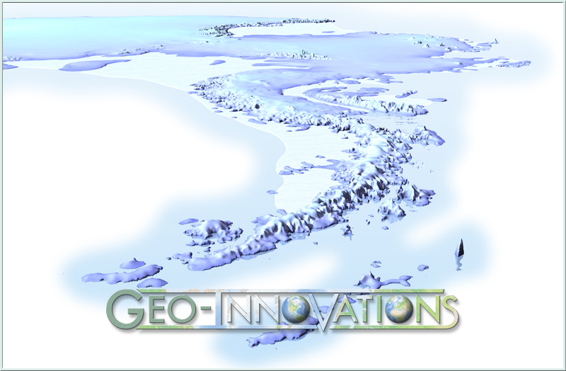
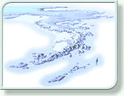 Imagine how a Laplander or and Eskimo sees the world? Imagine how a Laplander or and Eskimo sees the world?
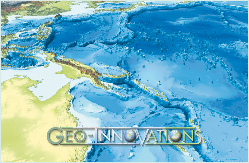
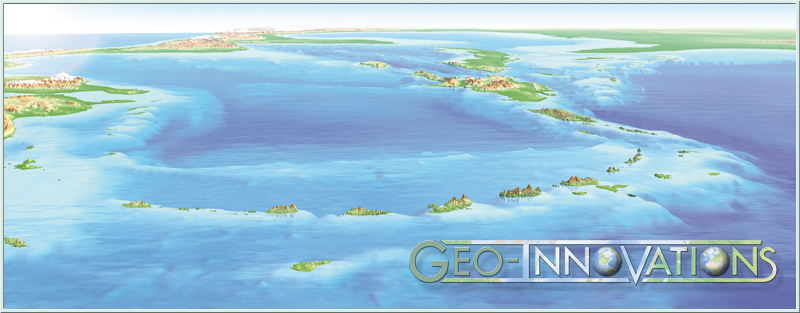
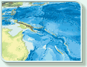
Imagine what it would be like if the seas suddenly dried up, and we could walk across the ocean floors. We would see great chasms, deeper than Everest is high; volcanoes bubbling over the ocean floor, some so high that they poke their noses out of the water. Perhaps we would also see the scars left behind as the earth has torn itself apart over the millennia.
 Imagine the sheer majesty of the Andes mountains, shrouded in mist, and so sharp and steep that snow cannot settle in many places. Imagine the sheer majesty of the Andes mountains, shrouded in mist, and so sharp and steep that snow cannot settle in many places.
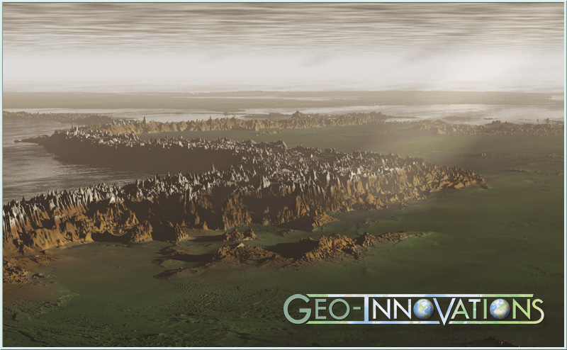
Imagine what it would be like watching the Australian landmass thundering northwards, riding over the Pacific Plate and crushing all before it: as will surely happen one day. Or going back in time just a few million years to see, in stark relief, the cataclysmic effect of India crashing into Asia and giving rise to the Himalayas.
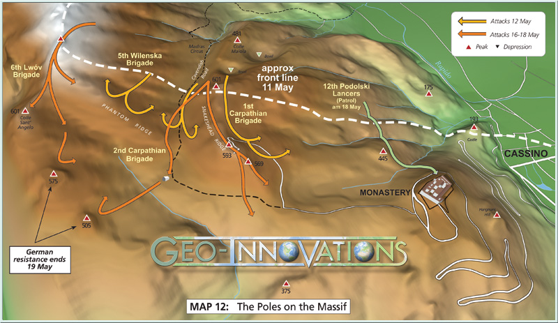
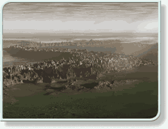
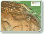
Imagine the past, and realise the effect that physical features had on world history. Travel along the Silk Route across Asia and see why Attilla the Hun and Ghengis Khan used the same well trodden route to conquer half the known world. See why the Russian Plains have defeated whole armies since time immemorial. Both Napoleon and Hitler misjudged their nature and expanse (Perhaps if they had seen our terrain visualisations first, world history might have been very different). Realise, perhaps for the first time, why the Indian nations gathered at the Little Bighorn and how important this battle site was, commanding, as it does, access to the Snake River Valley and then the whole west coast.
|
|
|
|
WITH GEO-INNOVATIONS YOU ARE NOW ONLY LIMITED BY YOUR IMAGINATION. |
|
|
 |
|
|
 |
|
|
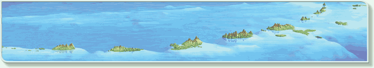
• Panoramic terrain visualisations
3D panoramic maps and diagrammatic cut-aways have always been the highlight of atlases and popular publications. Beautifully crafted by artists and illustrators, they describe objects and landscapes in ways that photographs and maps never can. Their promotional and selling power is enormous. However; despite their obvious successes, artists impressions will always be just that; artists impressions.
 If you have read this far into our website you will already know that we feel we are offering what authors and publishers have only dreamed about until now. Cartographically credible landscapes with all the atmospheric effects and promotional power of an artists drawing. If you have read this far into our website you will already know that we feel we are offering what authors and publishers have only dreamed about until now. Cartographically credible landscapes with all the atmospheric effects and promotional power of an artists drawing.
• The author in control
As soon as you contact Geo-Innovations we want you to feel that you have complete control over the whole project, from concept to completion. From a flurry of initial jpegs we hope you will be able to feel confident that we have interpreted your brief to the letter. We are happy to work fully with your designers to ensure that there is an integrated approach from start to finish, or conversely work with the author from the first sketch to the final digital masterpiece.
• Height Enhancement
The choice of the vertical exageration is never more important than with panoramic images. Gross exageration is quite aceptable in near vertical situations but would be totaly inapropriate for ground level shots. Geo-Innovations has tried and tested variables for each and every situation giving you a wide range of choices. |
|
|
• Elevation
From ground level to outer space, from sea level to the ocean floor, you are free to choose whatever elevation suits the purposes of your project. And because our system is fully interactive we can keep going up and down until you are satisfied. But this is only the start of the system that puts you completely in control
 • Angle of view • Angle of view
The simple choice of elevation is only a taste of the multiplicity of choices available to you. Do you want to look horizontally or vertically, or somewhere in between? Do you want to look north south, east or west, left a bit, right a bit, up a bit down a bit. Every possibility under the sun until we get it just right.
 • Atmospheres, the human touch • Atmospheres, the human touch
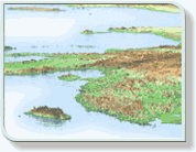
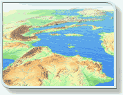
One of the most amazing features of the Geo-Innovations approach is its ability to generate the context of the landscape. The surface of the land does not exist in isolation. How the landscape looks depends on far more than just its shape. In reality lakes and oceans reflect their environment, the sky, the clouds, the mountains that surround them, so why shouldn’t a map do the same. It is these things that make a landscape look real.
Why shouldn’t a map have sky?
Why shouldn’t the land reflect the atmosphere which shrouds it and encompasses it?
Why can’t a map have shadows, rain, mist and sunsets, and still retain its cartographic credibility? The real world has all of these things and it does not detract in any way from our understanding or interpretation of it. On the contrary, our understanding is enhanced by these very elements. It is the human touch
|
|
|
|
|
|
 |
|
|
| The panoramic map provides the publisher to present to the reader images which reflect a uniquely human point of view, and this is a very powerful promotional aid. |
|
|
GEO-INNOVATIONS:
Britain’s leading exponent of world terrain visualisation and 3D mapping. |
|
|
|
|
|
|
|
|
|
|
|